State of Idaho
The territory comprised within the
State of Idaho was the last in the Union to be trodden by the
foot of the white man. Originally claimed by Spain under her
claim to the whole of the New World, and lying between what was
later acknowledged Spanish territory on the south and the
territory on the north claimed first by France and later held by
England, it was not reached by the early Spanish explorations
which in the two and a half centuries following the voyages of
Columbus penetrated some part of the country now included in
each State south of the forty-second parallel and west of the
Mississippi River.
Following Magellan's passage around
South America in 1520, the wave of exploration quickly rolled up
the western coast of the New World, and was soon followed, at
first by a few and later by increasing numbers of trading
vessels intent on barter with the natives. But this wave rolled
back from the rugged coast line like the ebb of the tide or the
retreat of the great storm waves baffled and broken after
flinging themselves in impotent fury against the rocky barrier.
These traders barely touched the coast, their penetration of the
interior being confined to finding some sheltered inlet
affording safe anchorage for the ship while bartering with the
inhabitants of the coast and such tribes as came down from the
interior for that purpose. These men never passed even the
Cascade Range, and that any of them ever saw any portion of the
present State of Idaho is improbable.
The real explorers of the interior of
that part of the North American continent now included in the
United States and Canada were the French and French Canadian
"voyageurs," those hardy men of the lake, stream and forest who
at first under French, and later under English auspices and
leadership, came by the way of the St. Lawrence and the Great
Lakes, and traversed the continent from the mouth of the
Mississippi to that of the McKenzie, and from Newfoundland to
Vancouver. Sometimes they went as missionaries, fired with
religious zeal; more often as trappers bent on obtaining by any
means at their command the wealth of furs this great region then
afforded. Both by training and by habit they were travelers by
water rather than by land. They were expert in the building and
handling of the canoes and light boats so well adapted to the
navigation of the rivers and lakes so numerous in the interior
of the continent, especially in the region of the Great Lakes
and the vast expanse of country to the west and northwest of
them. They so much preferred traveling by water that it was only
with great reluctance and when the point desired could not be
reached in any other way that they could be induced to travel
overland.
From the northern shores of Lake
Superior there is, through a marvelous network of lakes and
rivers, an almost unbroken water route northwest down the
McKenzie to the Arctic Ocean, and up the Peace and Athabaska,
western tributaries of the McKenzie, and the two branches of the
Saskatchewan, falling ultimately into Hudson's Bay, to the
eastern base of the Rocky Mountains. This fact, coupled with the
other important one that the animals whose furs were most sought
were more numerous and more easily caught along the streams than
away from them, accounts for the deflection of the early
explorations from this source to the northwest instead of going
directly west across the continent in the latitude of Idaho.
Thus it happened that Idaho, walled in on the east, west and
north by giant mountains, and penetrated only by rivers flowing
to the Pacific and the Great Salt Lake, was passed by, while the
continent was crossed and re-crossed both north and south of it.
Many Spanish expeditions from the
time of the bombastic Balboa had reached the Pacific overland,
but none of them north of the Bay of San Francisco. Alexander
McKenzie, in the employ of the Northwest Fur Company, after
having in 1789 first explored to the Arctic Ocean the river
which has since borne his name, started late in 1792 from his
base at Fort Chipewyan on Lake Athabaska in an endeavor to reach
the Pacific. He proceeded up Peace River, and, after wintering
500 miles to the southwest, where the party almost perished from
cold, he continued up the river and by a short portage across
the Rockies and down a tributary of the Frazer and the main
stream itself to near the Blackwater, a branch coming in from
the west, thence overland to the Pacific at North Bentinck Arm.
He returned by the .same route, arriving at Fort Chipewyan in
September.
The early accounts of many regions
are largely traditional, and in them a little truth is so
blended with fable or gross exaggeration that it is often a
difficult matter to winnow the kernels of historical fact from
the chaff in which they are concealed. This is true of Idaho,
but in a comparatively small degree only. The first mention of
the Rocky Mountains in the latitude of Idaho is found in La
Hontan's account of his pretended "journey up the long river" in
1688. He tells of having met four men who informed him they
lived in "the country farthest to the north and west then known,
and beyond mountains six leagues broad, and so high one must
cast an infinity of windings and turnings before he can cross
them," and that their principal river "runs a great way
westward" and empties into a vast salt lake. It is supposed the
"long river" is the Missouri, the mountains one of the numerous
ranges of the Rocky Mountains and "the river flowing west" the
Columbia or possibly the Colorado. The first Europeans to see
the Rocky Mountains in this latitude were undoubtedly the
members of Verendrye's party of French and Canadian explorers,
traders and hunters, who, having proceeded westward from Lake
Superior to a distance much greater than that at which they
expected to find the mountains, were in January, 1743,
confronted by the rugged, snowy ranges of western Montana, and,
despairing of reaching by that route the ocean they were
seeking, turned south and east, returning by the way of the
Yellowstone River.
It is probable that the first white
man who set foot on the soil of Idaho was one of those
adventurous fur traders or trappers who pushed out far in
advance as the Hudson Bay and Northwest companies extended their
operations across the continent. Most of these men were of
French descent, many of them half-breeds, and after they became
engaged in this work they knew no home but the wilderness. They
took Indian wives, lived among the Indians, and to a large
extent adopted the Indian mode of life. But they left no story
of their travels, no description of the new regions visited.
Trained to reticence along this line, and to deception if too
closely questioned, they never told what they had found, for the
reason that each desired to preserve for himself or his company
the desirable new hunting and trapping grounds he had
discovered. Consequently they do not count, either as a matter
of history or so far as the world of today is concerned.
Eliminating these trappers and fur
traders, it remained for the Lewis and Clarke government
exploring expedition of 1805-06 to first penetrate this region
of towering mountains, vast forests, extensive plains, dark,
silent lakes and mighty rushing rivers, and give the story to
the world. Having passed the winter of 1804-05 on the Missouri
River near where Bismarck, North Dakota, now stands, the Lewis
and Clarke party of thirty-two persons proceeded up the river to
the junction of Horse Prairie Creek with Reed Rock Creek,
between where the towns of Red Rock and Dillon, Montana, now
are. Here the canoes were abandoned, and, horses having been
bought from the Indians, they advanced over practically the
present Salmon stage route up Horse Prairie Creek, crossing what
is now the Idaho State line on the ridge of the divide and down
Agency Creek, emerging into Lemhi valley near where Fort Lemhi
was later built. Thus did the first white men who have left
their story to posterity enter the State of Idaho. Their course
was north down the Lemhi, their intention being to follow the
stream until they reached the Columbia. When the rapids below
Salmon City were encountered a party was sent by land to explore
the river further down. They reported it impassable for canoes.
The attempt was then made to follow the Salmon by land, but
after a trial of two or three days the country became so rugged
the horses could go no further and this, too, had to be given
up. With difficulty the party found its way over the Bitter Root
Mountains north of Shoup, went down the Bitter Root valley to
the Lolo Fork, thence up that stream, over the Lolo pass, and,
proceeding between the North and Middle Forks of the Clearwater,
emerged into the prairie. At the junction of the North Fork of
the Clearwater with the main stream they constructed canoes and
embarked on the river on their way to the mouth of the Columbia.
The party had entered Idaho at the head of Agency Creek on the
12th of August, and it was the 10th of October when their canoes
crossed the western boundary at the junction of the Clearwater
and the Snake. They had traversed only territory now embraced in
the counties of Lemhi. Idaho and Nez Perce. In May and June of
1806 Lewis and Clarke were again on the Clearwater, on the
return trip. They did not touch Lemhi County on the return,
following the Nez Perce or Lolo trail over Lolo pass and almost
directly east by way of the Blackfoot River, reaching the
Missouri River north of where Helena now is.
Lewis and Clarke found the Indians of
Idaho in possession of articles of European manufacture, which
had been obtained mostly from trading vessels along the coast,
and had been passed in barter from tribe to tribe until they had
reached this remote region. As time went on the number of
traders and trappers who visited the country year by year
increased, as the fur trade of the interior of the continent
gradually pushed west-ward over the mountains. In 1809 the
trading post of Fort Henry was built on the Henry or North Fork
of the Snake in Fremont County. It was the first footing
established by white men in what is now Idaho, and has the
distinction of being the first post planted by citizens of the
United States west of the Rocky Mountains. It was built by Agent
Henry for the Missouri Fur Company, but, owing to Indian
hostilities, was abandoned in 1810.
In 1811 Astor's Pacific Fur Company
established a fort at Astoria at the mouth of the Columbia, and
several at interior points in Washington and Oregon. The war of
1812 stopped all American activity in the Northwest, and
everything American, including Astoria, was taken possession of
by the English and the English fur companies, and the authority
of the United States was not re-established until 1818. Within
the next fifteen years the American fur companies and traders
and trappers from the United States traversed the country each
year and the fur trade grew to enormous proportions. But little
of historical value concerning this period has come down to us
in authentic form.
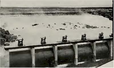
Idaho Irrigation Dam
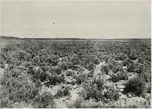
Idaho Sage Brush

Index
Source: Sketches of the Inter-Mountain
States, Utah, Idaho and Nevada, Published by The Salt Lake
Tribune, Salt Lake City, Utah, 1909
|