Roosevelt County, Montana 1921
The county which possesses the
distinction of being named in honor of the great American
president, statesman, soldier and naturalist, Col. Theodore
Roosevelt, is one of the youngest of Montana's counties, having
been created February 18, 1919. Its early history is that of
Sheridan County, of which it was formerly a part, and of North
Dakota, which state forms its eastern boundary line. Situated as
it is in the northeastern part of the state, during the early
days it was the scene of many conflicts between the Indians and
the white settlers, but this matter is covered in another
chapter of this work, dealing with the settlement of the
pioneers who pushed over the line of the territory from North
Dakota and points to the east and south.
Farming and Stock Raising
Roosevelt County has a land area of
2,355 square miles, and is eighty miles long and thirty miles
wide. Its altitude, 1,922 feet, is the lowest in the state. It
is exclusively an agricultural and stock raising county, and
while non-irrigated farming predominates over the irrigated
method, when the Fort Peck Indian Reservation Reclamation
Project in the western part of the county is completed by the
United States Government, 152,000 acres will be irrigated in one
body. All of the county is practically a rolling prairie
country, with a soil varying from a deep heavy chocolate loam to
a light sandy loam, well adapted for large scale operations, a
fact which was recognized by the Montana Farming Corporation (a
Morgan concern) which has leased several thousand acres on the
Fort Peck Reservation and is raising wheat and flax on a big
scale. In addition to these, corn and hay are the chief crops,
although before the coming of the agriculturally inclined
settlers this region was noted among stockmen for its growth of
heavy, luxurious and nutritious grasses.
Aside from agriculture, stock raising
is the chief industry, and much progress has been made in
establishing pure-bred cattle herds. A Tri-County Stock Show for
Sheridan, Roosevelt and Richland counties is held annually at
Culbertson and is considered to be one of the most complete in
the state. The Shorthorn herd owned by Lowe & Powers, at this
point, is accounted the best herd in Northeastern Montana and
Western North Dakota.
Aside from the Missouri River, which
marks the county's southern boundary, the principal stream in
Roosevelt County is the Poplar River, flowing southerly through
the county and emptying into the Missouri, hut there are also a
number of smaller streams, notably Big Muddy Creek, all
tributaries of the Missouri. Non-irrigated farms in this county
sell from $25 to $50 an acre, irrigated farms considerably
higher, and grazing land considerably less. Some of the lands
under the ditches of the Fort Peck Indian Project are being sold
by Indians who have received patent in fee to their allotments,
at prices ranging from $30 to $50 an acre, the purchaser
assuming the construction costs.
Mineral Resources
In the matter of timber, cottonwood
and ash are to be found along the streams, but there are no
commercial stands of marketable lumber.
The mineral resources are much more
valuable, for fine beds of lignite coal of good quality are
found throughout the county, and there has been considerable
prospecting for oil and gas. The indications for the development
of these industries are considered promising. In case that such
industries develop, there will be no serious difficulties in the
way of securing transportation facilities, as the main line of
the Great Northern Railroad parallels the Missouri River
throughout the county, and a branch line runs north from
Bainville into Sheridan County, while another branch from
Snowden runs south into Richland County. The Roosevelt Memorial
Highway follows the main line of the Great Northern.
While still a county in its infancy,
prior to its creation Roosevelt had the benefit of the work done
in the way of development by Sheridan County, and this included
the establishment of a public school system. In addition to
rural and graded schools, there are four high schools in the
county. Those at Poplar, Culbertson and Wolf Point are
accredited for the four-year term, and the school at Bainville
for two years. According to the United States Census of 1920,
Roosevelt County has a population of 10,347, and its assessed
valuation is $20,060,127.
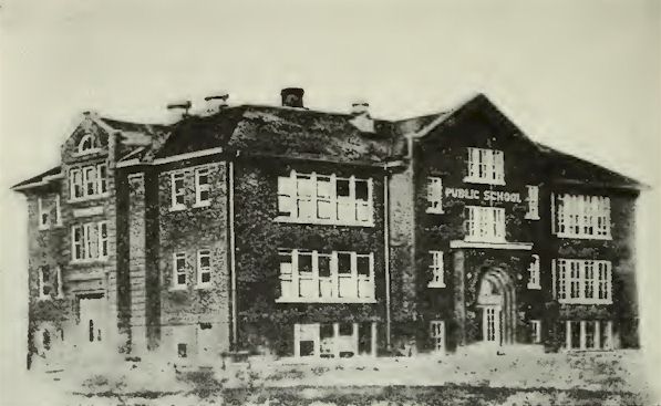
Wolf Point School
Wolf Point and Other Towns
The largest town in the county and
one which seems to have a bright future before it, not only on
account of the railroad shops but also because of the large
territory opening up around it in the Fort Peck Indian
Reservation Reclamation Project, is Wolf Point, situated in the
southwestern portion of the county. This is a railroad division
point on the main line of the Great Northern Railroad, and
according to the 1920 census report had a population of 2,098.
In 19 16 this community was only an Indian agency town, with a
population of 300 inhabitants. Today it has beautiful homes,
fine churches, a good school system and progressive business
establishments. Poplar, also located on the main line of the
Great Northern Railroad, and on the Missouri River, is a town
that is growing rapidly and by the 1920 census had a population
of 1,152.
This community is one that attracts
interest because of the unique Indian Fair held every year. It
is situated on the river whose name it bears. The little town of
Mondak, in the extreme southeastern corner of the county, was
made the temporary county seat at the time of the county's
creation.
One of the oldest towns in the
eastern portion of the state is Culbertson, which, with a
population of only 347, has taken the lead in encouraging the
growing of pure-bred livestock, and holds an annual stock show
at which exhibitors come from various parts of Roosevelt and the
adjoining counties of Sheridan and Richland. Bainville, another
town in the eastern part of the county, had a population of 396
at the last census report, but is growing rapidly because of its
good railroad facilities. This town is also the site of a flour
mill with a capacity of 550 barrels daily, the largest in
Northeastern Montana or Northwestern North Dakota, which is
supplied by grain due to its railroad facilities and is in
constant operation. The town is also becoming quite a shipping
point and presents an opening for wholesale branch houses. Other
thriving little towns, owing their importance chiefly to the
fact that they lie in the midst of rich agricultural districts,
are Froid, McCabe and Brockton.
Montana Counties 1921
Return to
Montana AHGP

Source: Montana its Story and Biography,
by Tom Strout, Volume 1, The American Historical Society, 1921
|